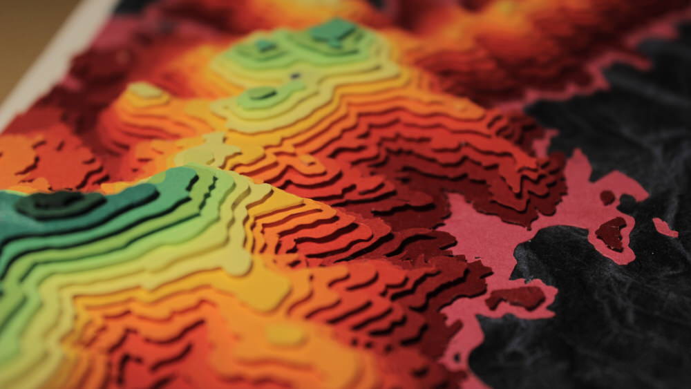
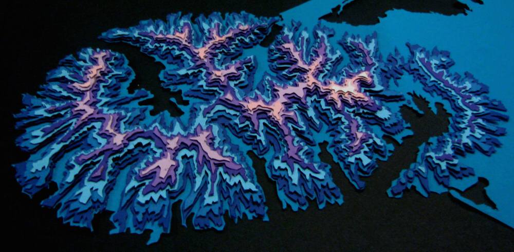
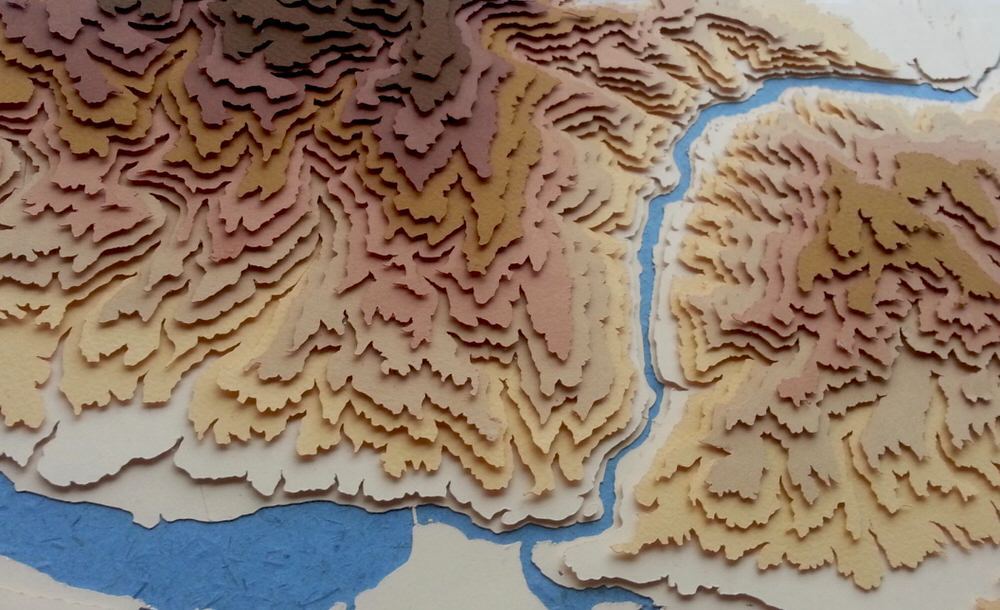
Sam Caldwell makes maps, topographically contoured maps, and they are truly a marvel to behold. He cuts out seemingly irregular shapes in coloured paper, with each defining the contour line of a certain altitude, and these are then layered up to create a 3 dimensional map which portrays a region’s landscape.
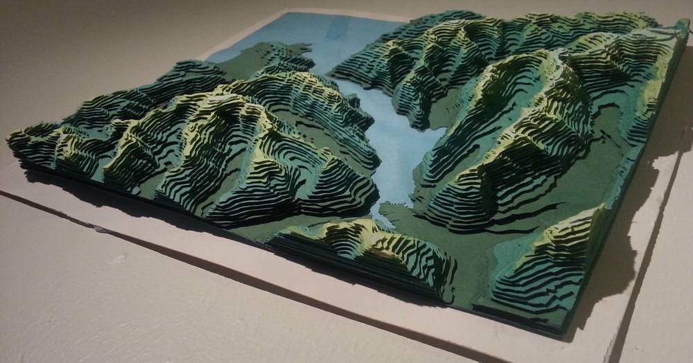
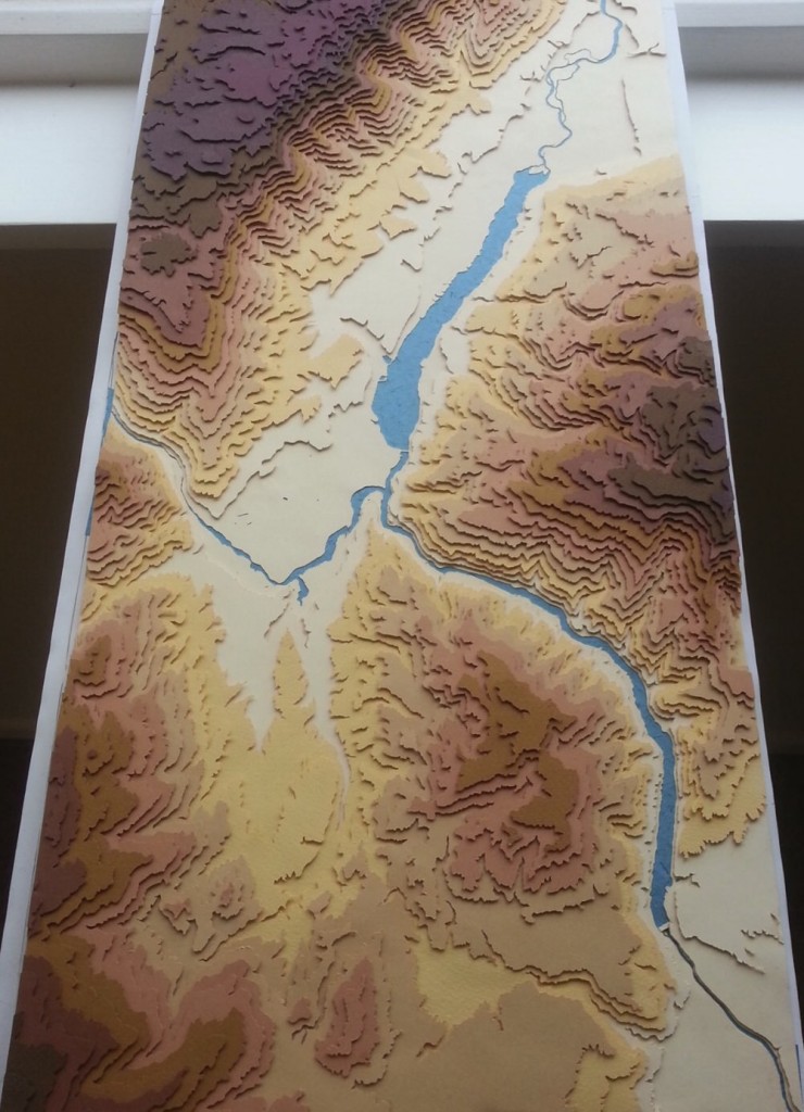
This self produced 10 minute documentary shows Sam’s thought process, early experimental works, and a step-by-step view of how he creates his maps from start to finish. His earliest maps were hand-cut with xacto knives — such as the map of Milford Sound pictured below which took Sam months to create!
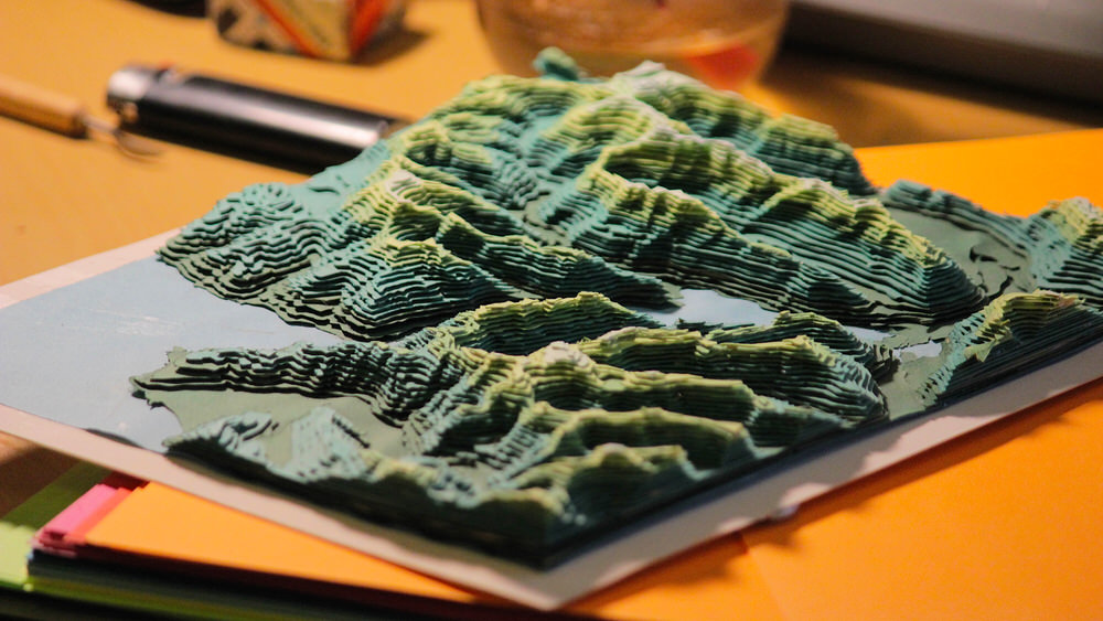
However he has recently acquired a Silhouette Cameo paper cutting machine which has sped up his workflow considerably, although there is still a hell of a lot of work that goes into assembling each map layer by layer.
The layers are interspersed with 1mm thick spacers (usually small triangular pieces of card or matchsticks) which give his topographical maps real depth. The suspended layers of coloured paper cast shadows over the preceding layer, the orientation of which change throughout the day as the sunlight pans across a room.
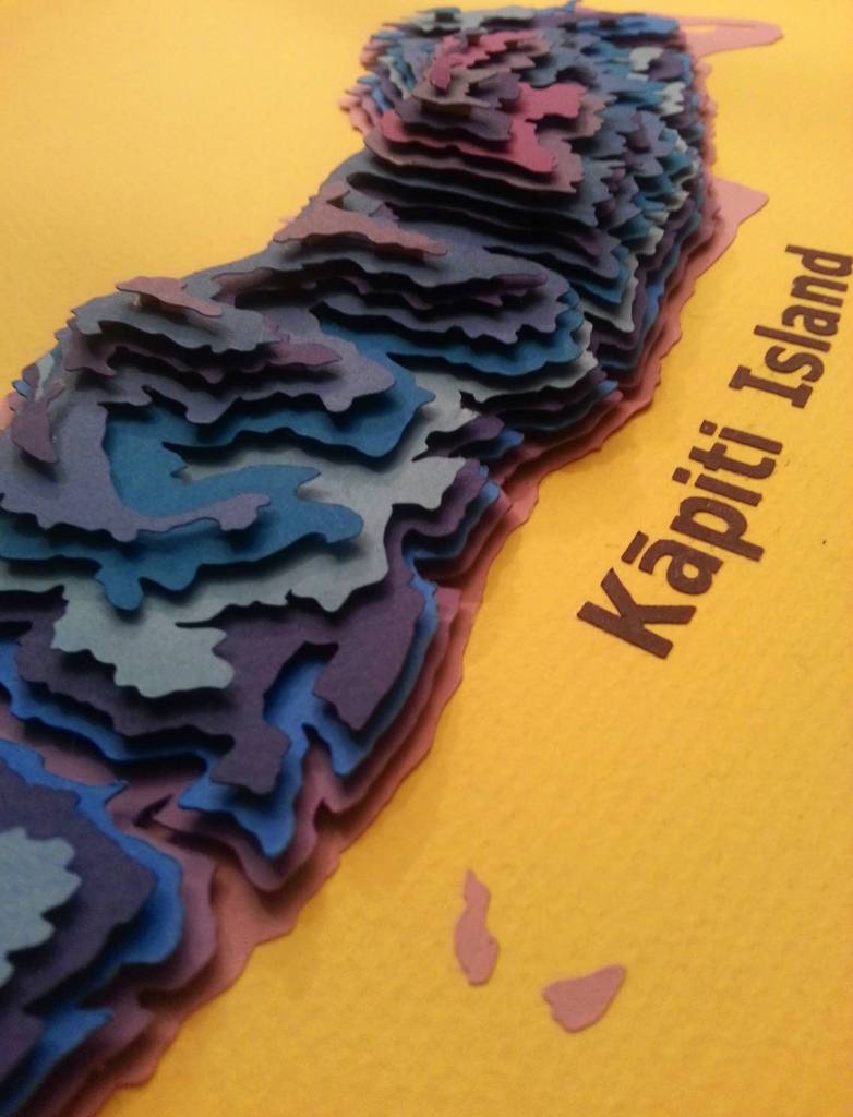
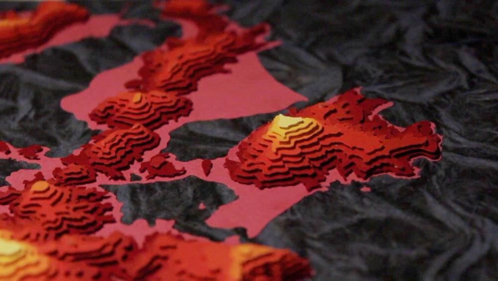
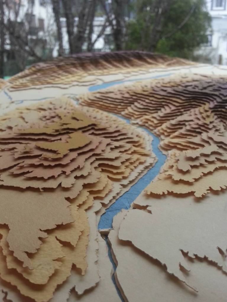
His maps tend to be incredibly vibrant, with each layer of the terrain being composed of a different coloured paper, such as the rainbow spectrums as seen in this map of Ōtepoti. Some have also made use of the more refined beige-brown-purple colour progression often seen in geographical terrain relief maps.
Sam plans on creating even more complex maps in the future, possibly incorporating variations in ocean floor depths, as well as buildings and bridges.
There is no official SAMAPS website or shop yet but you can view more of Sam’s remarkable layered paper maps, and keep up to date with his latest works, through his Facebook page. You can also contact him on the email address featured at the end of the video above regarding commissions.
Share this Post
Further Info
| Artist | Sam Caldwell |
|---|---|
| SAMAPS NZ |


Comments
Do you create raised maps for entire USA – all elevations & only showing border lines of individual States ? Price for completed project? 1 yard x 1 yard 36” x 36”.
great designs, marvelous craftsmanship…john